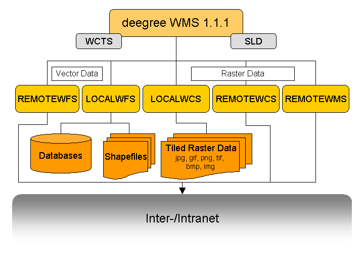
Configuration of the new deegree WMS differs slightly from the one used so far. There is no explicit Capabilities-document used any more and there are two ways to configure a WMS.
A substantial difference is that in comparison to deegree 0.7.x, deegree 1.x.x WMS does not realize direct proprietary data access (Shapefiles, Oracle Spatial, ...) any more. All data that is used to create a map will be accessed via a WFS, WCS or another WMS. WFS and WCS can be realized locally – i.e. in the same Virtual Machine (VM) as the deegree WMS – or remotely as a web service (Figure 1). Different WMS layers can be delivered by different WFS, WCS, or WMS servers.
As there is no separate Capabilities-document any more, this is created dynamically out of the configuration files when requested (GetCapabilities Request).
The two configuration possibilities are different in regard to the options a user has. The ‘Short Configuration’ is a subset of the ‘Full-Configuration’. Optional settings do not have to be provided for the ‘Short Configuration’ and a number of configuration parameters are set to default values. This reduces the possibilities of the user, but simplifies the configuration substantually.
The configuration of the data sources is not affected by this, this means even while using the ‘Short Configuration’ the default LOCALWFS has to be configured as described in the WFS configuration. The transition between full and short configuration is fluent.
